| Contributors | Affiliation | Role |
|---|---|---|
| Hoge, Frank E. | National Aeronautics and Space Administration (NASA) | Principal Investigator |
| Chandler, Cynthia L. | Woods Hole Oceanographic Institution (WHOI BCO-DMO) | BCO-DMO Data Manager |
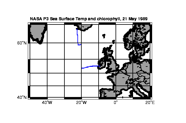
   PI:              Frank Hoge
   of:              NASA/Goddard Space Flight Ctr., Wallops Island, VA
   dataset:         Aircraft observed sea surface temperature and chlorophyll
   dates:           May 21, 1989
   location:        N: 63.872  S: 51.6826  W: -22.7278  E: -9.1751
   project/cruise:  NABE/NASA P3 flight of May 21, 1989
   ship:            NASA P3 aircraft


   Flight track

   Flight leg notes:
   Flight leg 1
   Starting Coordinates:  52 36.6 N 09 10.5 W
   Ending Coordinates:    52 24.7 N 14 59.7 W
   Flight leg 2
   Starting Coordinates:  52 18.2 N 15 49.2 W
   Ending Coordinates:    52 05.3 N 17 19.3 W
   Flight leg 3 not reported
   Flight leg 4
   Starting Coordinates:  51 40.8 N 20 00.1 W
   Ending Coordinates:    55 22.8 N 19 51.6 W
   Flight leg 5
   Starting Coordinates:  55 42.3 N 19 59.8 W
   Ending Coordinates:    59 32.1 N 20 03.5 W
   Flight leg 6
   Starting Coordinates:  59 32.4 N 20 04.6 W
   Ending Coordinates:    59 40.6 N 22 01.3 W
   Flight leg 7
   Starting Coordinates:  60 01.0 N 22 03.6 W
   Ending Coordinates:    63 52.3 N 22 43.7 W
for the JGOFS North Atlantic Bloom Experiment (NABE)
21 May 1989 Frank Hoge
NASA/Goddard Space Flight Ctr., Wallops Island, VA
The laser-induced chlorophyll fluorescence has been normalized by the water
Raman backscatter to correct for variations in the optical attenuation properties
of the upper water column along the flight track. A discussion of the AOL
instrumentation and the water Raman normalization procedure are given in
the references listed below. The laser-induced chlorophyll fluorescence
was acquired using 532 nm excitation from a frequency doubled Nd:YAG laser
with an output power of ~15 mjoule/pulse. The laser was operated at 10 pulses/second.
At the nominal 120 m/sec velocity of the NASA P-3A aircraft, this sampling
rate yields an observation every 1.2 m along the flight track. The data
contained in these files are 30 point simple averages providing an observation
approximately every 0.4 km. The 532 nm laser excitation also stimulates
fluorescence from the phycoerythrin pigment contained in some strains of
marine phytoplankton. The amount of laser-induced phycoerythrin fluorescence
found during the 21 May 1989 survey was found to be low (below the detection
limitation of the AOL sensor) and accordingly is not included with the data
set contained on this disk.
The relationship between water Raman normalized laser-induced chlorophyll
fluorescence ratio and chlorophyll concentration varies somewhat due to
changes in the fluorescence pigment quantum efficiency of the in situ chlorophyll
molecules much as chlorophyll fluorescence from a continuous underway fluorometer
does. Changes in the fluorescence quantum efficiency are affected by such
factors as available light, nutrients, etc., however from previous experiments
we have seldom seen variations in excess of 20% within a single mission
over a period of 4 to 5 hours under daylight conditions. In comparing the
data set with available chlorophyll data from the R/V Discovery (U.K.) over
a contemporaneous span between 52.5 N and 53.5 N (over a period of 9 - 17
hours after the airborne sampling) we found that a scale factor 4.95 applied
to the water Raman normalized laser-induced chlorophyll provided reasonable
agreement. The data set from the R/V Discovery and the Raman normalized
laser-induced chlorophyll fluorescence data from the AOL were resampled
at 0.02 degree increments as a function of latitude and combined. A linear
regression between the absolute chlorophyll values and the chlorophyll fluorescence
yielded an R coefficient of 0.80 and the above 4.95 scale factor between
the Raman normalized laser-induced chlorophyll fluorescence values and chlorophyll
in ug/liter units. The 4.95 scale factor was applied to all data sets obtained
during the May 21 mission. The SST observations were collected from an auxiliary
Barnes PRT-5 infrared radiometer. A linear regression of the PRT-5 ocean
surface temperature values along all 7 flight lines with the ocean surface
temperature values from the Airborne Expendable Bathythermographs (AXBT's)
yielded a r coefficient of 0.95. Note that Leg 3 was not included because
of some instrument problems experienced at that point in the mission.
References:
Hoge, F. E., and R. N. Swift, Airborne dual laser excitation and mapping
of phytoplankton photopigments in a Gulf Stream warm core ring, Appl.
Opt. 22, 2272-2281, 1983.
Smith, R. C., O. B. Brown, F. E. Hoge, K. S. Baker, R. H. Evans, R.
N. Swift, and W. E. Esaias, Multiplatform sampling (ship, aircraft, and
satellite) of a Gulf Stream warm core ring, Appl. Opt. 26, 2068-2081,
1987a.
| File |
|---|
SST_chl.csv (Comma Separated Values (.csv), 185.47 KB) MD5:adf0323f2e7f1cc35f08bc2cae250794 Primary data file for dataset ID 2623 |
| Parameter | Description | Units |
| leg | cruise or flight track segment | |
| time | GMT time (seconds of the day) (May 21, 1989) | seconds |
| lat | latitude, minus = South | decimal degrees |
| lon | longitude, minus = West | decimal degrees |
| temp_sst | temperature, sea surface, from infrared radiometer | decimal degrees C |
| LIF | Raman normalized Laser-Induced | |
| chl | chlorophyll as calculated from LIF ratios | micrograms/liter |
| Dataset-specific Instrument Name | Light Detection and Ranging System |
| Generic Instrument Name | Light Detection and Ranging System |
| Generic Instrument Description | The Light Detection and Ranging (LIDAR) system is an active remote sensing system that can be operated in either a profiling or scanning mode using pulses of light to illuminate the terrain. LIDAR data collection involves mounting an airborne laser scanning system onboard an aircraft along with a kinematic Global Positioning System (GPS) receiver to locate an x, y, z position and an inertial navigation system to monitor the pitch, roll, and heading of the aircraft. By accurately measuring the round trip travel time of the laser pulse from the aircraft to the ground, a highly accurate spot elevation can be calculated. Depending upon the altitude and speed of the aircraft along with the laser repetition rate it is possible to obtain point densities that would likely take months to collect using traditional ground survey methods (June 2010 definition from: http://www.ngs.noaa.gov/RESEARCH/RSD/main/lidar/lidar.shtml).The LIDAR transmitter uses a Galium-Aluminum-Arsenic laser which emits energy in pulses at a constant rate and wavelength. The LIDAR has two sounding modes: active and acoustic.
Note: A LIDAR system was used during US JGOFS Arabian Sea cruises to acquire SST, DOM and fluorometric pigment data, but there are also bathymetric LIDAR systems. |
| Website | |
| Platform | NASA P3 aircraft |
| Start Date | 1989-04-26 |
| End Date | 1989-06-03 |
One of the first major activities of JGOFS was a multinational pilot project, North Atlantic Bloom Experiment (NABE), carried out along longitude 20° West in 1989 through 1991. The United States participated in 1989 only, with the April deployment of two sediment trap arrays at 48° and 34° North. Three process-oriented cruises where conducted, April through July 1989, from R/V Atlantis II and R/V Endeavor focusing on sites at 46° and 59° North. Coordination of the NABE process-study cruises was supported by NSF-OCE award # 8814229. Ancillary sea surface mapping and AXBT profiling data were collected from NASA's P3 aircraft for a series of one day flights, April through June 1989.
A detailed description of NABE and the initial synthesis of the complete program data collection efforts appear in: Topical Studies in Oceanography, JGOFS: The North Atlantic Bloom Experiment (1993), Deep-Sea Research II, Volume 40 No. 1/2.
The U.S. JGOFS Data management office compiled a preliminary NABE data report of U.S. activities: Slagle, R. and G. Heimerdinger, 1991. U.S. Joint Global Ocean Flux Study, North Atlantic Bloom Experiment, Process Study Data Report P-1, April-July 1989. NODC/U.S. JGOFS Data Management Office, Woods Hole Oceanographic Institution, 315 pp. (out of print).
The United States Joint Global Ocean Flux Study was a national component of international JGOFS and an integral part of global climate change research.
The U.S. launched the Joint Global Ocean Flux Study (JGOFS) in the late 1980s to study the ocean carbon cycle. An ambitious goal was set to understand the controls on the concentrations and fluxes of carbon and associated nutrients in the ocean. A new field of ocean biogeochemistry emerged with an emphasis on quality measurements of carbon system parameters and interdisciplinary field studies of the biological, chemical and physical process which control the ocean carbon cycle. As we studied ocean biogeochemistry, we learned that our simple views of carbon uptake and transport were severely limited, and a new "wave" of ocean science was born. U.S. JGOFS has been supported primarily by the U.S. National Science Foundation in collaboration with the National Oceanic and Atmospheric Administration, the National Aeronautics and Space Administration, the Department of Energy and the Office of Naval Research. U.S. JGOFS, ended in 2005 with the conclusion of the Synthesis and Modeling Project (SMP).
| Funding Source | Award |
|---|---|
| National Aeronautics & Space Administration (NASA) |