Sample log for HADESK bacterial biomarker phospholipid fatty acid content from sediment cores collected on R/V Thomas G. Thompson cruise TN309, May 2014
Project
| Contributors | Affiliation | Role |
|---|---|---|
| Shank, Timothy M. | Woods Hole Oceanographic Institution (WHOI) | Principal Investigator |
| Drazen, Jeffrey C. | University of Hawaiʻi at Mānoa (SOEST) | Co-Principal Investigator |
| Yancey, Paul | Whitman College | Co-Principal Investigator |
| Copley, Nancy | Woods Hole Oceanographic Institution (WHOI BCO-DMO) | BCO-DMO Data Manager |
Abstract
This dataset contains the sample log for HADESK bacterial biomarker phospholipid fatty acid (PLFA) content from sediment push cores. The same samples were also used for the organic matter (OM) analysis. Samples were taken in the Kermadec Trench in the Southwest Pacific, 4000 to ~10,000m from the RV/ Thomas G. Thompson during cruise TN309, May 2014.
Push cores (6.35 cm diameter) of sediment were collected in situ using the manipulator arm of the Hybrid Remotely Operated Vehicle Nereus on the margin of the Kermadec Trench (6013m) and along the main trench axis (7137 to 9177m) at roughly 1000m increments.
Cores were sectioned at 1cm intervals and sieved for the meiofaunal fraction.
Upon retrieval of sediment cores, the 0-1, 1-2, 2-3, 3-5, 5-10 cm depth horizons were sectioned and stored frozen (-80 °C) until analysis. Benthic bacterial biomass were calculated from sediment concentrations of the bacterial biomarker phospholipid fatty acids (PLFAs) i14:0, i15:0, ai15:0, i16:0. In brief, PLFAs were extracted and purified from known quantities of freeze-dried sediment samples and subsequently derivatized to yield fatty acid methyl esters (FAMEs). FAMEs were quantified using GC-FID (Agilent Technologies 6890N). Bacterial biomass was calculated using the well-established PLFA:C conversion factor of 0.056 gC PLFA/gC biomass.
Attempts were made to obtain 3 replicate cores at each depth horizon (every 1000 meters from 6000m to 10,000m. For logistical reasons with vehicle performance (and loss at 10,000), all of the replicates were not able to be collected.
BCO-DMO Processing Notes:
- added conventional header with dataset name, PI name, version date
- modified parameter names to conform with BCO-DMO naming conventions
- re-formatted date from m/d/yyyy to yyyy-mm-dd
| File |
|---|
Kermadec_PLFA_OM_sample_log.csv (Comma Separated Values (.csv), 3.90 KB) MD5:a5d584119b5e2b972688c21f2fbd2ea6 Primary data file for dataset ID 763873 |
| File |
|---|
PLFAs derived biomass (mmol C m-2) vs. water depth (meters) filename: image014_PLFA_V_depth.png (Portable Network Graphics (.png), 30.30 KB) MD5:f92aac66ebd6cfb8e4a4a08bb5064a3f |
| Parameter | Description | Units |
| sample | sample identifier | unitless |
| cruise_id | cruise identifier | unitless |
| dive | dive identifier | unitless |
| site | site name | unitless |
| station | station identifier | unitless |
| core | core identifier | unitless |
| NiWa_id | National Institute for Water and Atmosphere identifier | unitless |
| date_utc | sample collection date in UTC | unitless |
| horizon_core_cm | depth horizon in core | centimeters |
| Dataset-specific Instrument Name | Fisons NA 1500 elemental analyzer |
| Generic Instrument Name | Elemental Analyzer |
| Generic Instrument Description | Instruments that quantify carbon, nitrogen and sometimes other elements by combusting the sample at very high temperature and assaying the resulting gaseous oxides. Usually used for samples including organic material. |
| Dataset-specific Instrument Name | |
| Generic Instrument Name | HROV Nereus |
| Generic Instrument Description | Nereus is an efficient, multi-purpose “hybrid” vehicle that can explore and operate in the crushing pressures of the greatest ocean depths. An unmanned vehicle, Nereus operates in two complementary modes. It can swim freely as an autonomous underwater vehicle (AUV) to survey large areas of the depths, map the seafloor, and give scientists a broad overview. When Nereus locates something interesting, the vehicle’s support team can bring the vehicle back on board the ship and transforms it into a remotely operated vehicle (ROV) tethered to the ship via a micro-thin, fiber-optic cable. Through this tether, Nereus can transmit high-quality, real-time video images and receive commands from skilled pilots on the ship to collect samples or conduct experiments with a manipulator arm.
Technical specifications:
Weight on land: 2,800 kg
Payload capacity: 25 kg
Maximum speed: 3 knots
Batteries: rechargable lithium ion, 15 kilowatt hours in two pressure housings
Thrusters: 2 fore and aft, 2 vertical, 1 lateral (ROV mode) 2 fore and aft, 1 vertical (AUV mode)
Lights: variable output LED array, strobes
Manipulator arm: Kraft TeleRobotics 7-function hydraulic manipulator
Sonar: scanning sonar, forward look and profile, 675 KHz
Sensors: magnetometer, CTD (to measure conductivity, temperature, and depth)
Nereus supports a variety of science operations: Push coring, measuring heat flow, geotechnical and geochemical sensing, rock sampling and drilling, biological sampling, water sampling, high resolution acoustic bathymetry, and optical still and video imagery.
More information is available from the operator site at URL. |
| Dataset-specific Instrument Name | |
| Generic Instrument Name | Push Corer |
| Dataset-specific Description | Push cores were borrowed from the National Deep Submergence Facility to be able to standardize results. The push cores were 6.35cm diameter). |
| Generic Instrument Description | Capable of being performed in numerous environments, push coring is just as it sounds. Push coring is simply pushing the core barrel (often an aluminum or polycarbonate tube) into the sediment by hand. A push core is useful in that it causes very little disturbance to the more delicate upper layers of a sub-aqueous sediment.
Description obtained from: http://web.whoi.edu/coastal-group/about/how-we-work/field-methods/coring/ |
TN309
| Website | |
| Platform | R/V Thomas G. Thompson |
| Start Date | 2014-04-10 |
| End Date | 2014-05-20 |
| Description | Original data are available from the NSF R2R data catalog |
Controls on Hadal Megafaunal Community Structure: a Systematic Examination of Pressure, Food Supply, and Topography (HADES)
Extracted from the NSF award abstract:
Severe technical challenges associated with the extremes of hydrostatic pressure have prevented major advances in hadal ecological studies, and relegated hadal systems to among the most poorly investigated habitats on Earth. Through this project, Hadal Ecosystems Studies (HADES) program, PIs will determine the composition and distribution of hadal species, the role of hadal pressures (piezolyte concentrations, enzyme function under pressure), food supply (distribution of POC with the abundance and biomass of trench organisms, and metabolic rates/energetic demand), and depth/topography (genetic divergence and spatial connectivity of populations) have on impacting deep-ocean community structure. This project will examine these factors using the world's first full-ocean depth hybrid remotely operated vehicle (HROV) in conjunction with the only full-ocean depth imaging lander (Hadal-Lander). This project will provide the first seafloor data and samples in one of the world's best, yet little known trenches- the Kermadec Trench (SW Pacific Ocean). Megafaunal community structure and the relationship between POC and benthic bacterial biomass will be examined as a function of depth and location by systematic high-definition imaging and sediment/faunal sampling transects from abyssal to full trench depths both along and perpendicular to the trench axis. Population genetic approaches will provide levels of genetic divergence and evolutionarily independent lineages to assess the role of depth and topography in trenches and their adjacent abyssal plain in promoting the formation of species. Physiological constraints will be investigated by examining in-situ respiration of selected fauna and tissue concentrations of such protein stabilizers as trimethylamine oxide (TMAO), and the structural adaptations of macromolecules.
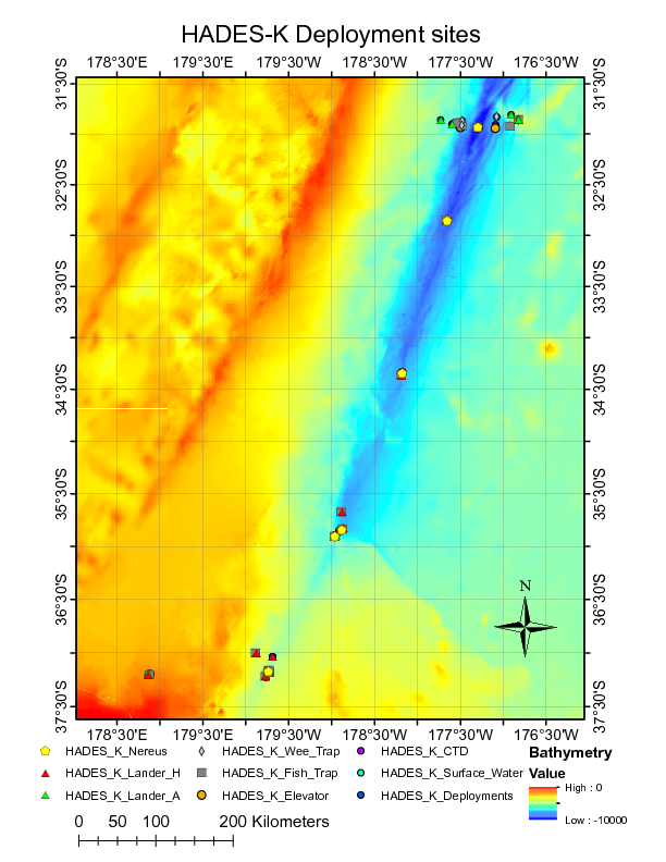
Image of NEREUS Deployment Sites. [click on the image to view a larger version]
| Funding Source | Award |
|---|---|
| NSF Division of Ocean Sciences (NSF OCE) |
[ table of contents | back to top ]