Attributes of communities-at-sea, including the size of servicesheds and climate change risk exposure scores, determined from Vessel Trip Report (VTR) data for commercial fishing trips from 1996 to 2014
Project
| Contributors | Affiliation | Role |
|---|---|---|
| Pinsky, Malin | Rutgers University | Principal Investigator |
| Rogers, Lauren | Stanford University | Principal Investigator, Contact |
| Griffin, Robert | Stanford University | Co-Principal Investigator |
| St. Martin, Kevin | Rutgers University | Co-Principal Investigator |
| Fuller, Emma | Princeton University | Scientist |
| Young, Talia | Rutgers University | Scientist |
| Rauch, Shannon | Woods Hole Oceanographic Institution (WHOI BCO-DMO) | BCO-DMO Data Manager |
Abstract
Communities-at-sea are peer-groups of vessels which share a gear type and are associated with a particular port (e.g., vessels from New Bedford, MA that use gillnets). For vessels using trawl gear, small and large trawlers are considered separate communities according to vessel length (<> 65 feet). We used Vessel Trip Report (VTR) data for commercial fishing trips from 1996 to 2014, as reported by vessel captains, to determine the at-sea "servicesheds" or customary fishing grounds of communities.
The following methods are excerpted from Rogers et al. (in press):
A trip was classified as belonging to a community if it shared the community's gear type and landing port, and the vessel either declared that port as its principal port or landed in that port at least 50% of its trips that year.
Once aggregated into communities, trips were then weighted by a variable (“fisherdays”) indicating labor time expended on each trip: trip length (in days) multiplied by the number of crew on board. Fisherdays indicate how important an area at sea is to a community in terms of how much time they invest in that location.
Given reported trip locations and fisherdays, we then created raster maps using a kernel density method. The resultant maps distribute fisherdays using different size kernels depending upon the fishery/gear-type/length. Nearshore fishing was processed using a smaller kernel (7.5 - 10 km) than offshore fishing (10 - 15 km). We used the area defined by a 90% volume contour (i.e., an area which encompasses 90% of fisherdays) to define the customary fishing grounds or servicesheds for a community.
To compare the relative historical importance of particular species to a community-at-sea, landings data were compiled from vessel trip reports and summed over the available years of data for each community. Price information was extracted from NOAA Fisheries, Fisheries Statistics Division (https://www.st.nmfs.noaa.gov/st1/commercial/landings/annual_landings.html). We used the average price per lb by species, adjusted for inflation (real 2014 prices in US$), over the period for which we had community-level data. State-level prices were used when available, and otherwise regional prices were used.
We assessed a community's exposure to risk based on their historical dependence on species and spatial fishing patterns. A community was more exposed to risk if the species from which it historically earned the most revenue were projected to lose habitat in the locations where the community has traditionally fished. Specifically, risk exposure scores for communities were calculated as:
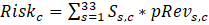
where Sₛ,꜀ is the mean projected change in habitat suitability for species s across the serviceshed of community c, and pRevₛ,꜀ is the proportion of historical revenues from fishing that the community has derived from species s. Positive risk exposure scores indicated expanding opportunities for communities based on their historical fishing revenue portfolios and projected changes to species habitat at sea, while negative values indicated shrinking opportunities and increased exposure to negative impacts of climate change.
The R file, "Servicesheds.rData" (see "Supplemental Documents" below) is a spatial polygon dataframe (SPDF) giving 90% volume contours of fisher-days at sea for 98 communities-at-sea. The polygons outline the at-sea "servicesheds" or customary fishing grounds of communities. We use "serviceshed" to describe the area from which a community has historically received ecosystem services, specifically fish in this case. The file is intended to be read by the program "R", with data stored in the SPDF object "Servicesheds".
Data were processed using R version 3.4.4.
| File |
|---|
community_attributes_risk.csv (Comma Separated Values (.csv), 7.47 KB) MD5:3b58972e0817ebcd6932b478117e6e4a Primary data file for dataset ID 765477 |
| File |
|---|
Servicesheds.RData (R Script, 322.09 KB) MD5:82c036cf67a09a96a4271d58b8b85bbb A spatial polygon dataframe (SPDF) giving 90% volume contours of fisher-days at sea for 98 communities-at-sea. The polygons outline the at-sea "servicesheds" or customary fishing grounds of communities. The file is intended to be read by the program “R”, with data stored in the SPDF object “Servicesheds”.
|
| Parameter | Description | Units |
| Community | Community-at-sea name, indicating port city and gear/vessel type | unitless |
| Port | Port city | unitless |
| State | State | unitless |
| Gear | Type of fishing gear/vessel. Large Trawl indicates vessels longer than 65 feet using trawl gear. Small Trawl are vessels less than 65 feet using trawl gear. | unitless |
| PortLon | Longitude of port city. | degrees East |
| PortLat | Latitude of port city. | degrees North |
| Fleetsize | Average number of vessels in the community. | number of vessels |
| Trips | Total number of trips taken over the duration of the study. | number of trips |
| Years | Number of years the community was extant. | number of years |
| ShedArea | Area of the serviceshed, defined as the 90% volume contour of fisher days at sea. | square kilometers (sq km) |
| RiskExposure | Calculated risk exposure score based on projected changes in habitat suitability for harvested species. Negative values indicate increased exposure to risk. | unitless |
Adaptations of fish and fishing communities to rapid climate change (CC Fishery Adaptations)
Description from NSF award abstract:
Climate change presents a profound challenge to the sustainability of coastal systems. Most research has overlooked the important coupling between human responses to climate effects and the cumulative impacts of these responses on ecosystems. Fisheries are a prime example of this feedback: climate changes cause shifts in species distributions and abundances, and fisheries adapt to these shifts. However, changes in the location and intensity of fishing also have major ecosystem impacts. This project's goal is to understand how climate and fishing interact to affect the long-term sustainability of marine populations and the ecosystem services they support. In addition, the project will explore how to design fisheries management and other institutions that are robust to climate-driven shifts in species distributions. The project focuses on fisheries for summer flounder and hake on the northeast U.S. continental shelf, which target some of the most rapidly shifting species in North America. By focusing on factors affecting the adaptation of fish, fisheries, fishing communities, and management institutions to the impacts of climate change, this project will have direct application to coastal sustainability. The project involves close collaboration with the National Oceanic and Atmospheric Administration, and researchers will conduct regular presentations for and maintain frequent dialogue with the Mid-Atlantic and New England Fisheries Management Councils in charge of the summer flounder and hake fisheries. To enhance undergraduate education, project participants will design a new online laboratory investigation to explore the impacts of climate change on fisheries, complete with visualization tools that allow students to explore inquiry-driven problems and that highlight the benefits of teaching with authentic data. This project is supported as part of the National Science Foundation's Coastal Science, Engineering, and Education for Sustainability program - Coastal SEES.
The project will address three questions:
1) How do the interacting impacts of fishing and climate change affect the persistence, abundance, and distribution of marine fishes?
2) How do fishers and fishing communities adapt to species range shifts and related changes in abundance? and
3) Which institutions create incentives that sustain or maximize the value of natural capital and comprehensive social wealth in the face of rapid climate change?
An interdisciplinary team of scientists will use dynamic range and statistical models with four decades of geo-referenced data on fisheries catch and fish biogeography to determine how fish populations are affected by the cumulative impacts of fishing, climate, and changing species interactions. The group will then use comprehensive information on changes in fisher behavior to understand how fishers respond to changes in species distribution and abundance. Interviews will explore the social, regulatory, and economic factors that shape these strategies. Finally, a bioeconomic model for summer flounder and hake fisheries will examine how spatial distribution of regulatory authority, social feedbacks within human communities, and uncertainty affect society's ability to maintain natural and social capital.
| Funding Source | Award |
|---|---|
| NSF Division of Ocean Sciences (NSF OCE) |
[ table of contents | back to top ]