Sea ice parameters near McMurdo Station, Antarctica from 1986 to 2013
Project
| Contributors | Affiliation | Role |
|---|---|---|
| Kim, Stacy | Moss Landing Marine Laboratories (MLML) | Principal Investigator, Contact |
| Ainley, David G. | H.T. Harvey & Associates | Co-Principal Investigator |
| Ballard, Grant | Point Blue Conservation Science | Co-Principal Investigator |
| Daly, Kendra L. | University of South Florida (USF) | Co-Principal Investigator |
| York, Amber D. | Woods Hole Oceanographic Institution (WHOI BCO-DMO) | BCO-DMO Data Manager |
Abstract
Actual sampling location varied slightly between years and may be obtainable from support contractor records. Approximate location of sampling was McMurdo Station, Antarctica (77°51′14″S, 166°28′07″E). The number of measurements varied between different years from 1 to 20. All data were collected within an area of approximately 0.28 km2, at a standard suite of 16 stations along a 3000 m distance, and five stations across an orthogonal 1000 m distance.
At each station, small holes were drilled through the ice and the thickness measured using a meter tape with a lever-arm that held the zero-point against the bottom of the fast ice. Thickness was measured for solid ice and did not include underlying brash ice or frazil ice, nor overlying snow.
Notes:
1999 began collection of additional data on time of day and snow depth
2003 began collection of additional data from shipping channel sites
2006 stopped collection of shipping channel site data, began collection of additional data on ice temperature profiles
2010 did not collect ice temperature profile data.
For access to additional data that are available but not transcribed into this data set; please contact authors to obtain access.
Version 1 (2017-01-18):
* data file imported into the BCO-DMO data system.
* added a conventional header with dataset name, PI name, version date
* modified parameter names to conform with BCO-DMO naming conventions
* blank values replaced with no data value 'nd'
* added approximate latitude and longitude of sampling location near McMurdo Station.
Version 2 (2023-10-12) replaces version 1 (2017-01-18):
* Version 2 corrects issues in version 1;
** values in ice_thickness_median, and ice_temp_median columns were corrected to in 2010, 2011, and 2013 as the values for ice thickness and ice temperature were reversed within each year.
** dates 1/3/02, 2/6/02, and 3/1/02 changed to 1/3/03, 2/6/03, and 3/1/03 respectively. The corresponding "year" column changes from 2002 to 2003 for each of the three dates.
* date file IceThickRev.csv imported into the BCO-DMO data system as version 2 with "nd" as the missing data identifier.
** Missing data values are displayed differently based on the file format you download. They are blank in csv files, "NaN" in MatLab files, etc.
* Date converted to ISO 8601 format
| File |
|---|
675187_v2_ice_thick.csv (Comma Separated Values (.csv), 19.52 KB) MD5:71fc5b3d08f379324496ba1cfde66acd Primary data file for dataset ID 675187, version 2 |
| Parameter | Description | Units |
| lat_approx | Approximate latitude of sampling near McMurdo Station; Antarctica; south is negative | decimal degrees |
| lon_approx | Approximate longitude of sampling near McMurdo Station; Antarctica; west is negative | decimal degrees |
| date | sampling date in ISO 8601 format | unitless |
| year | sampling year | unitless |
| month | sampling month | unitless |
| day | sampling day | unitless |
| ice_thickness_median | median ice thickness | centimeters |
| ice_temp_median | median ice temperature | degrees Celsius |
| air_temp | air temp | degrees Celsius |
| Dataset-specific Instrument Name | meter tape |
| Generic Instrument Name | Measuring Tape |
| Generic Instrument Description | A tape measure or measuring tape is a flexible ruler. It consists of a ribbon of cloth, plastic, fibre glass, or metal strip with linear-measurement markings. It is a common tool for measuring distance or length. |
McMurdo_IceThickness_1986-2013
| Website | |
| Platform | McMurdo Station |
| Start Date | 1986-10-01 |
| End Date | 2013-11-30 |
Food web dynamics in an intact ecosystem: the role of top predators in McMurdo Sound (McMurdo Predator Prey)
Extracted from the NSF award abstract:
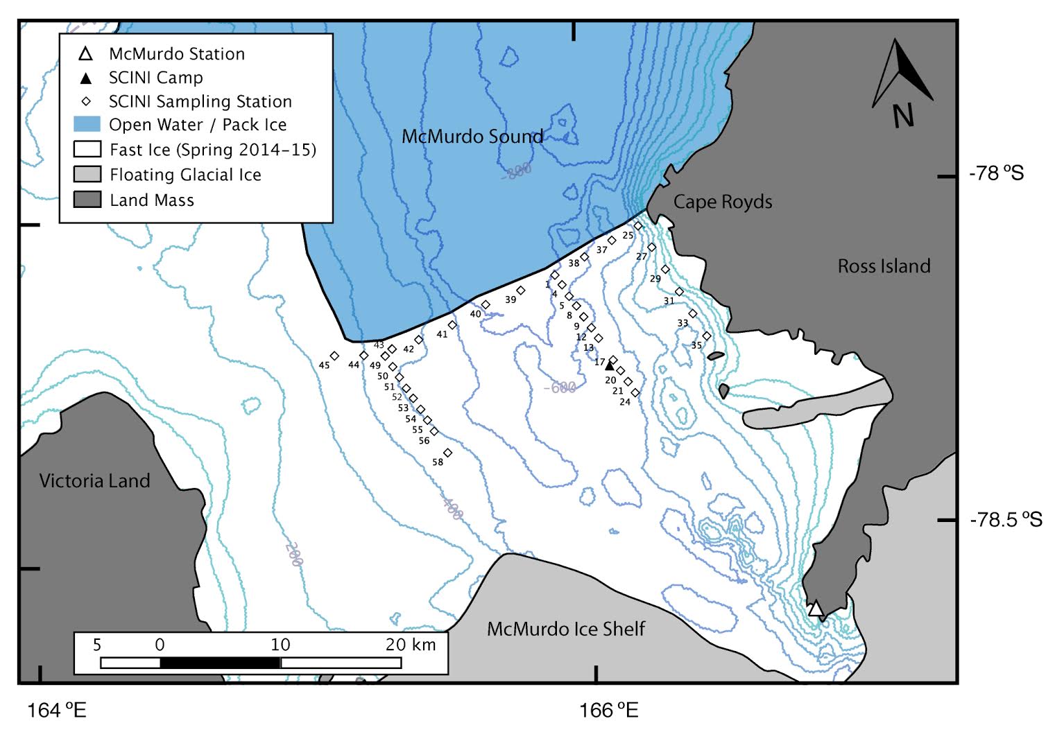
The research project investigates the importance of top down forcing on pelagic food webs. The relatively pristine Ross Sea includes large populations of upper-level predators such as minke and killer whales, Adélie and Emperor penguins, and Antarctic toothfish. This project focuses on food web interactions of Adélie penguins, minke whales, and the fish-eating Ross Sea killer whales, all of which exert foraging pressure on their main prey, crystal krill (Euphausia cyrstallorophias) and silver fish (Pleuragramma antarcticum) in McMurdo Sound.
The investigators used a video- and acoustic-capable ROV, and standard biological and environmental sensors to quantify the abundance and distribution of phytoplankton, sea ice biota, prey, and relevant habitat data. The sampling area included 37 stations across an 30 x 15 km section of McMurdo Sound, stratified by distance from the ice edge as a proxy for air-breathing predator access. This study will be among the first to assess top-down forcing in the Ross Sea ecosystem and will form the basis for multidisciplinary studies in the future.
Map sampling stations
| Funding Source | Award |
|---|---|
| NSF Division of Polar Programs (NSF PLR) | |
| NSF Division of Polar Programs (NSF PLR) | |
| NSF Division of Polar Programs (NSF PLR) |
[ table of contents | back to top ]