| Data File(s) | Type | Description | Action |
|---|---|---|---|
2014_quadrat_photos.zip (5.39 GB) | ZIP Archive (ZIP) | Quadrat photos from 2014. See benthic cover data table for data quantified from these images. | |
2015_01_quadrat_photos.zip (1.04 GB) | ZIP Archive (ZIP) | Quadrat photos from January and February of 2015. See benthic cover data table for data quantified from these images. | |
2015_05_quadrat_photos.zip (1.49 GB) | ZIP Archive (ZIP) | Quadrat photos from June 6th to 20th, 2015. See benthic cover data table for data quantified from these images. | |
2016_quadrat_photos.zip (374.85 MB) | ZIP Archive (ZIP) | Quadrat photos from 2016. See benthic cover data table for data quantified from these images. | |
2017_quadrat_photos.zip (3.31 GB) | ZIP Archive (ZIP) | Quadrat photos from 2017. See benthic cover data table for data quantified from these images. | |
benthic_cover.csv (74.47 KB) | Comma Separated Values (.csv) | Primary data file for dataset ID 862410 | |
| Supplemental File(s) | Type | Description | Action |
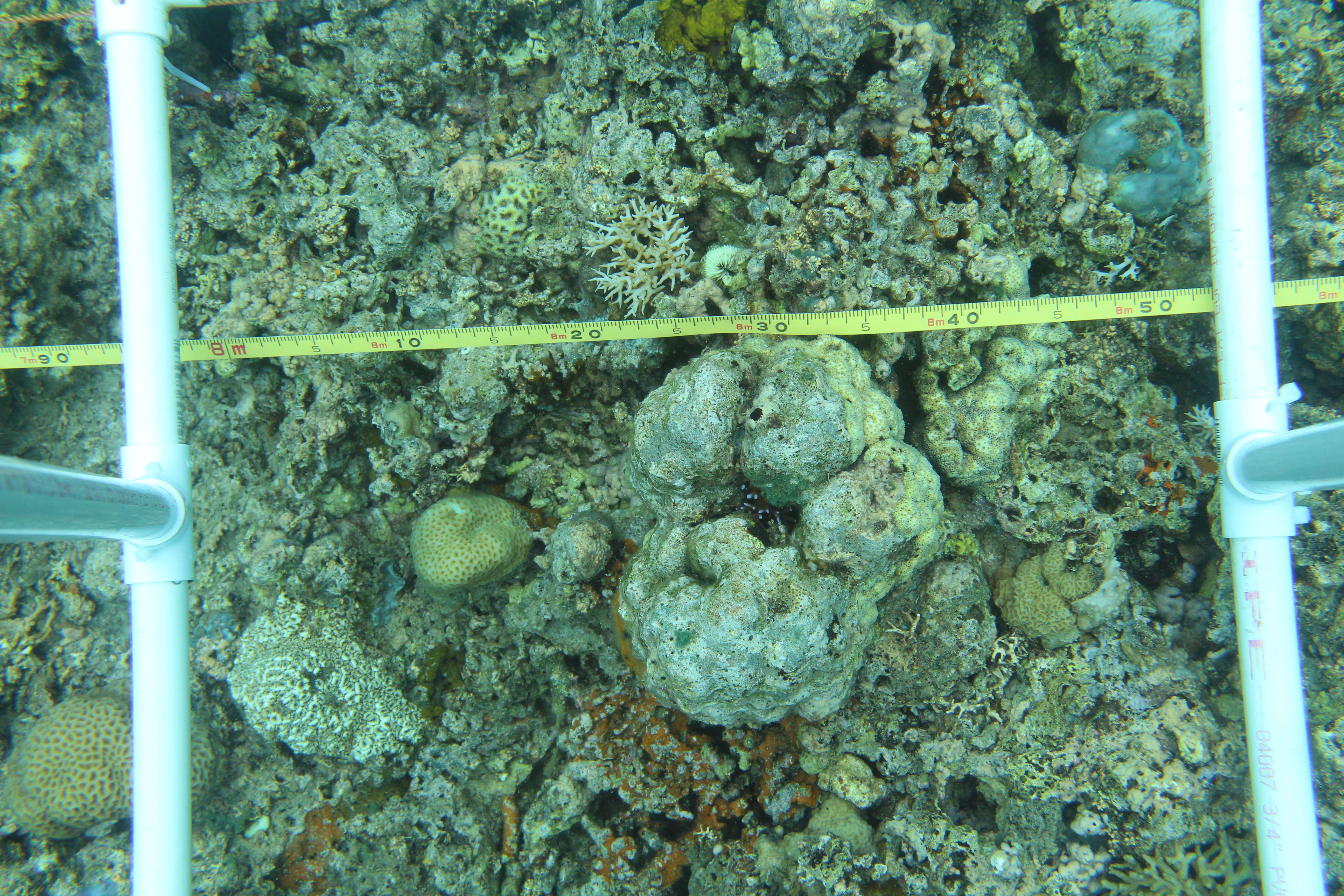
IMG_1603.JPG (9.97 MB)  | JPEG Image (.jpg) | Example quadrat photo. This image is included along with the other quadrat photos bundled in zip files which can be downloaded from the "Data Files" section. | |
transect_locations.csv (51.60 KB) | Comma Separated Values (.csv) | Transect and quadrat information. Lat/lon points are usually the southern edge of the transect. Parameters (column name, description, and units): survey_season = year of survey season site = site name Type = type (Fixed or Random) direction= Direction (e.g. NE for North East) Waypoint Name =Waypoint name (e.g. Cabatoan F1 real) lat = latitude in decimal degrees lon = longitude in decima... |
Files
Type: ZIP Archive (ZIP)
Quadrat photos from 2014. See benthic cover data table for data quantified from these images.
Type: ZIP Archive (ZIP)
Quadrat photos from January and February of 2015. See benthic cover data table for data quantified from these images.
Type: ZIP Archive (ZIP)
Quadrat photos from June 6th to 20th, 2015. See benthic cover data table for data quantified from these images.
Type: ZIP Archive (ZIP)
Quadrat photos from 2016. See benthic cover data table for data quantified from these images.
Type: ZIP Archive (ZIP)
Quadrat photos from 2017. See benthic cover data table for data quantified from these images.
Type: Comma Separated Values (.csv)
Primary data file for dataset ID 862410
Supplemental Files
Type: JPEG Image (.jpg)
Example quadrat photo. This image is included along with the other quadrat photos bundled in zip files which can be downloaded from the "Data Files" section.

Type: Comma Separated Values (.csv)
Transect and quadrat information. Lat/lon points are usually the southern edge of the transect. Parameters (column name, description, and units): survey_season = year of survey season site = site name Type = type (Fixed or Random) direction= ...